The Circuit, Day by Day
Most trekkers walk the circuit counterclockwise (west to east), finishing at Villa Cerro Castillo or the Río Ibáñez junction on the Carretera Austral.
More remote than Torres del Paine. Half the crowds, twice the solitude.
Day 1 — Villa to Campamento Neozelandés
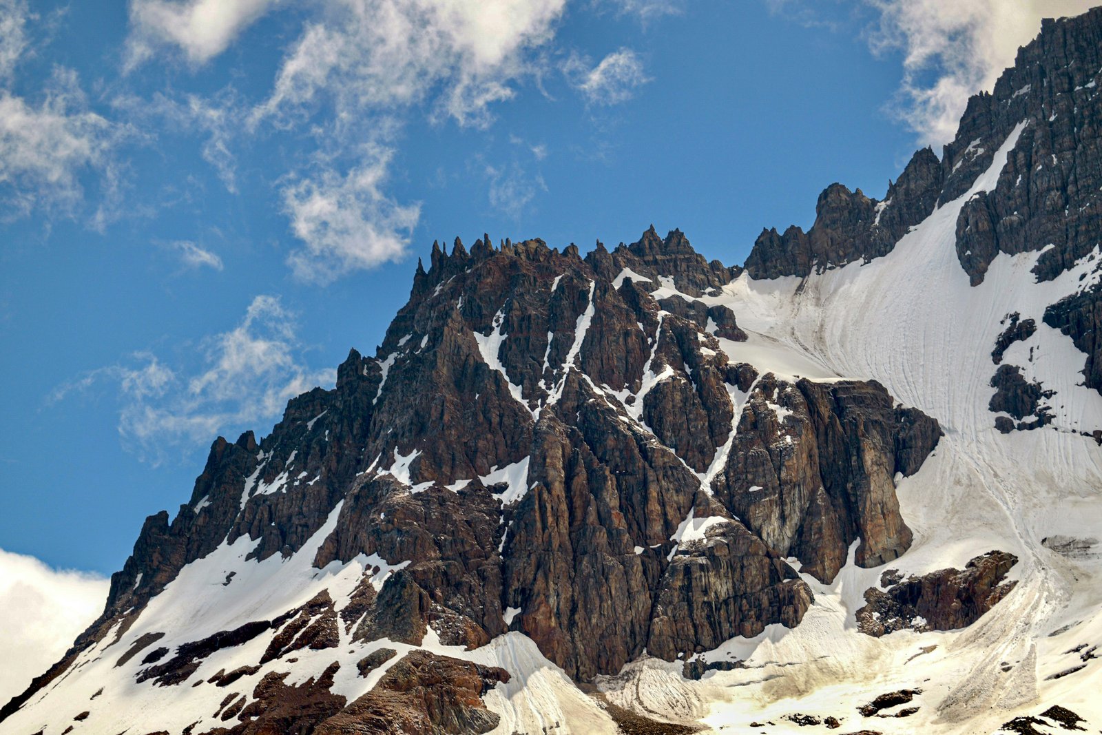
The circuit begins at Villa Cerro Castillo on the Carretera Austral, 75km south of Coyhaique. The trail climbs steadily through lenga beech forest along the Estero Parada before breaking into open alpine terrain. At kilometre 12, the first views of the Cerro Castillo massif appear: a wall of black basalt spires with glaciers clinging to the south faces. Campamento Neozelandés sits in a wide clearing at the base of the main tower group. This is the most photographed camp on the circuit — the towers are directly above and visible from the sleeping area.
Day 2 — Neozelandés over Portezuelo
Day 2 is the hardest and the most dramatic. The trail climbs 800 metres from Neozelandés to the Portezuelo Cerro Castillo pass at 1,870m on steep loose scree and snow in early season. The final 300 metres to the pass involves scrambling with hands on rock. At the pass, the view opens across the full Río Ibáñez valley and the back side of the massif — the east faces of the spires are a different colour and texture from the west, darker and more severely fractured. From the pass, the descent toward Campamento Las Horquetas follows a long ridge before dropping into a valley floor where the first river crossing of the circuit occurs.
Day 3 — Las Horquetas and the Mirador
Day 3 follows the eastern side of the circuit, descending the Río Castillo valley with the massif visible above throughout. The route passes the Mirador Cerro Castillo, a 2-hour detour from the main trail that gives the best elevated view of the full spire array from the east. This is the photo point most people use for the circuit. The main trail continues through increasingly open pampa grassland, with the Patagonian steppe beginning to replace the lenga beech as the valley opens toward the Carretera Austral.
Day 4 — Exit to Carretera Austral
The final day is the most straightforward: a gradual descent through the Río Ibáñez valley to the Carretera Austral junction. The last 8km follow the Ibáñez riverbank through open steppe, with the river crossing by suspension bridge at the circuit end. From the junction, trekkers can hitchhike or walk 6km back into Villa Cerro Castillo. If you started the circuit from the Carretera Austral junction instead of the village, you close the loop here. Most people who timed it right can catch the afternoon bus from the junction toward Coyhaique or Puerto Ibáñez.
Guided Experiences near Cerro Castillo
The Cerro Castillo circuit is less visited than Torres del Paine but more technical — river crossings and route-finding on Day 2 benefit from local guide knowledge.
Guided 4-day circuit
Full 4-day circuit with a local mountain guide. River crossing support, camp placement advice, and terrain explanation on the exposed Day 2 ridge approach to Portezuelo del Viento.
Browse guided circuits →Photography-focused day hike
Guided day hike to the laguna at the base of the Cerro Castillo spires. Smaller group, photo-oriented pace with stops at the best compositions. Based from Villa Cerro Castillo.
Book day hike →Transport + porter support
Logistics service for independent trekkers: shuttle from Coyhaique to trailhead, porter for heavy camp gear on Day 2, and return pickup. Ideal for a self-guided traverse.
Arrange logistics →Links go to GetYourGuide for real-time availability. Check dates and guide certifications before booking.
Cerro Castillo sits 75km south of Coyhaique, in a part of Chilean Patagonia that most Torres del Paine visitors never reach. The circuit covers 60km and crosses one serious mountain pass, but the distinguishing feature is not the difficulty — it is what the massif looks like. Black volcanic basalt carved into spires and towers over a hanging glacier, above a valley floor of emerald lenga beech and turquoise river. The crowds have not found it yet. That will change.
How to get there
Fly into Balmaceda (BBA) — 56km from Coyhaique — or directly into Coyhaique (GXQ). LATAM and Sky Airline fly from Santiago (2.5h). A shuttle connects Balmaceda airport to Coyhaique ($10–15 USD, ~45 min).
Daily bus in summer (Dec–Mar) from Coyhaique to Villa Cerro Castillo — 1.5 hours, ~2,500 CLP ($3 USD). Off-season service is reduced. Alternatively, rent a car from Coyhaique: Route 7 is partly paved, partly gravel to the trailhead.
From Puerto Montt, drive the Carretera Austral south (2–3 days) with ferry crossings at Hornopirén and La Arena. Cerro Castillo sits roughly halfway down the route — a natural stop on a full Austral road trip.
Camping and logistics
No refugios on the circuit. Four campsites with flat ground and water only — no infrastructure.
Patagonian nights at altitude are cold year-round. A 3-season bag is the minimum viable option.
No resupply on trail. Pack out all food waste — Leave No Trace is enforced on the circuit.
No fire facilities on circuit. Buy gas canisters in Coyhaique before reaching the trailhead.
Free registration at the Villa Cerro Castillo trailhead office. Required before starting.
Abundant on trail but purify before drinking — cattle graze the lower valley sections.
When to go
The window is short: December through March. January and February are the most reliable for settled weather, though even in peak summer Patagonian conditions can change in hours. The Portezuelo pass can hold significant snow through late December; check conditions with the registration office before departing. April brings rapid deterioration and snow at altitude becomes a serious hazard. The circuit is effectively inaccessible from May to October.
Where to sleep
Hostel / camping · Villa Cerro Castillo
The trailhead village has simple hostels ($15–25/night) and paid camping ($5–10/night). Facilities are basic but enough for pre- and post-circuit logistics.
Hotel / guesthouse · Coyhaique
Coyhaique (75km north) has the best services in the Aysén Region: restaurants, gear shops, and comfortable guesthouses ($50–90/night). A practical pre-circuit base.
Lodge · Carretera Austral
Boutique lodges on the Carretera Austral between Coyhaique and the trailhead offer spectacular settings. Limited options — book well ahead for peak season.
Cerro Castillo in Photos
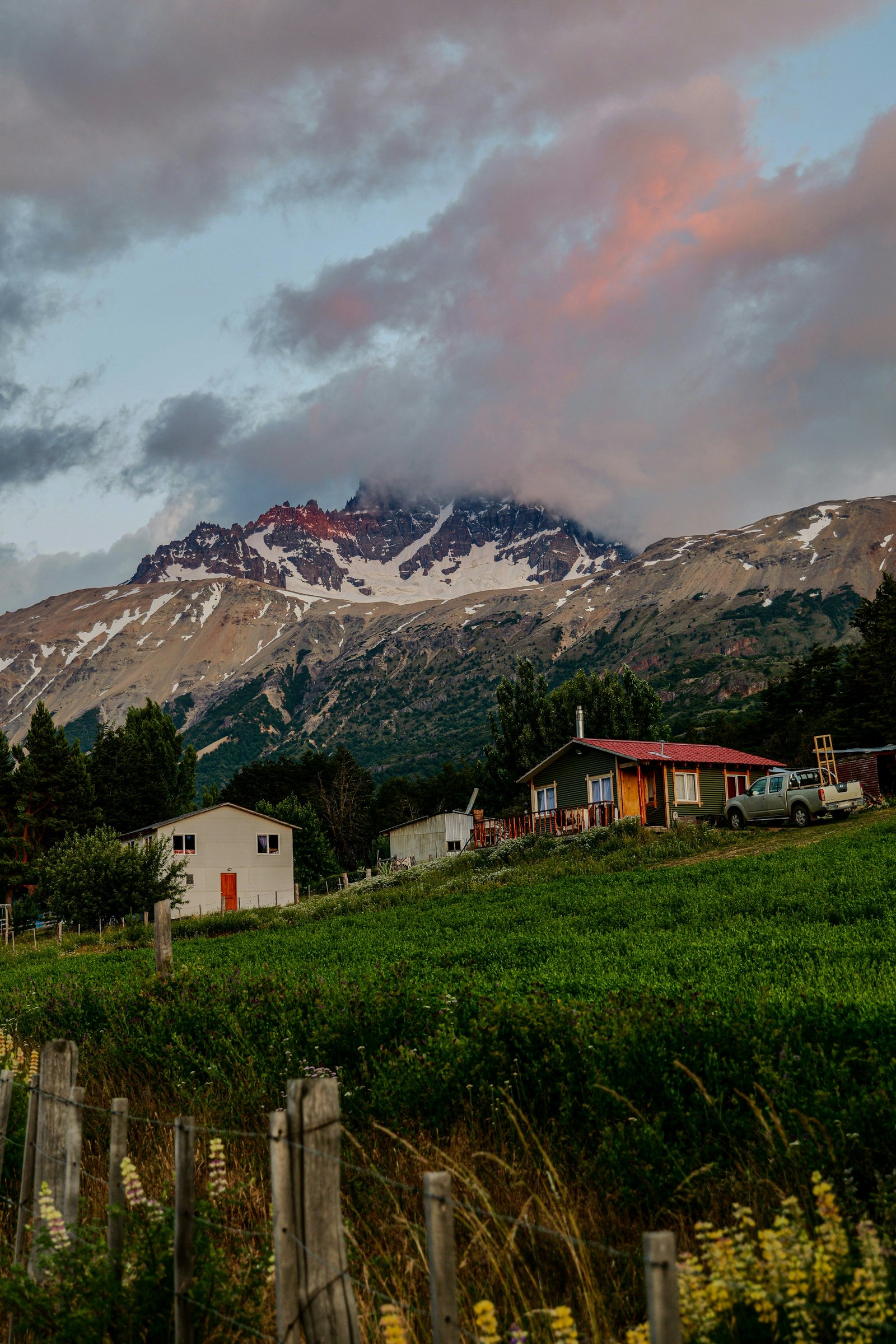
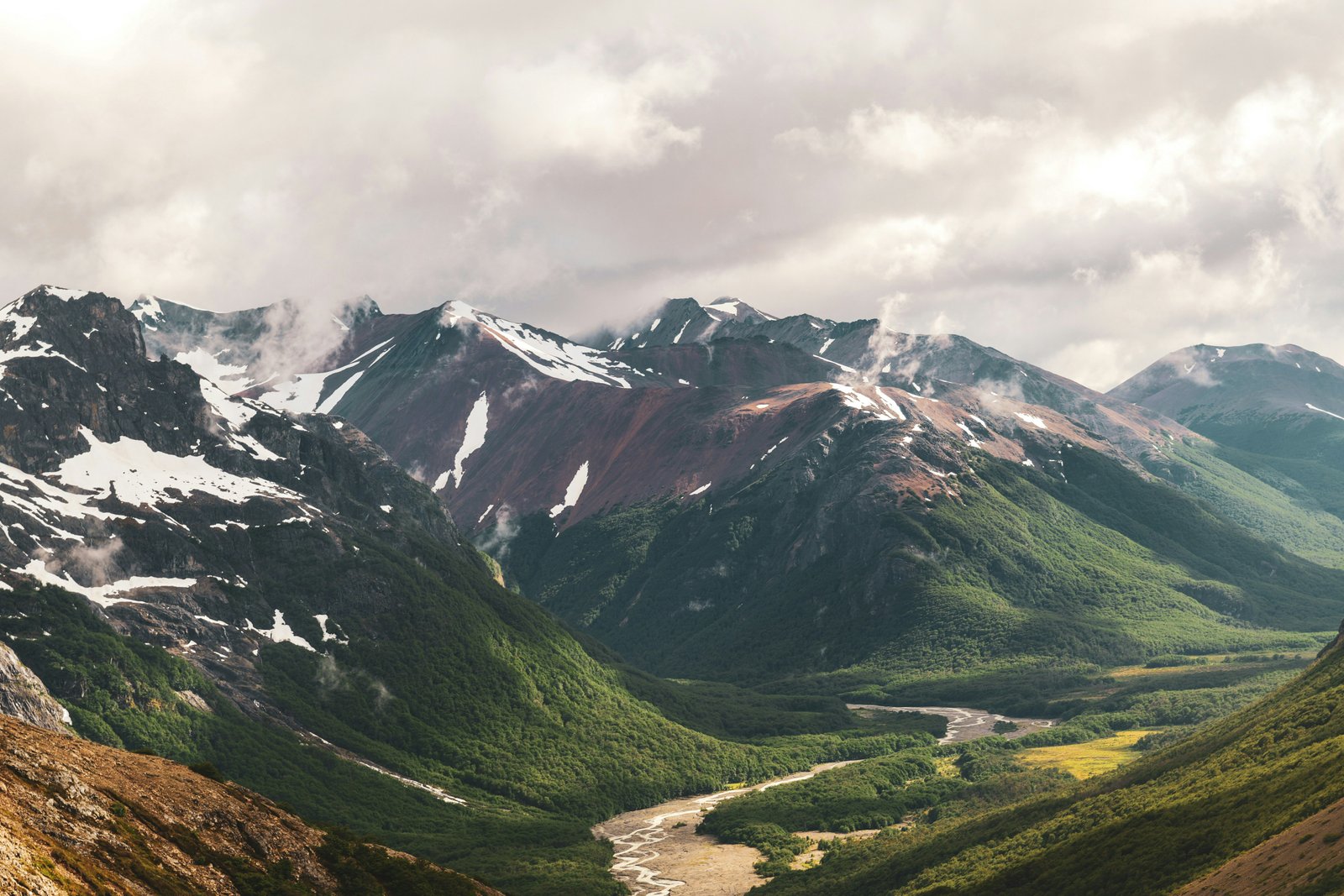
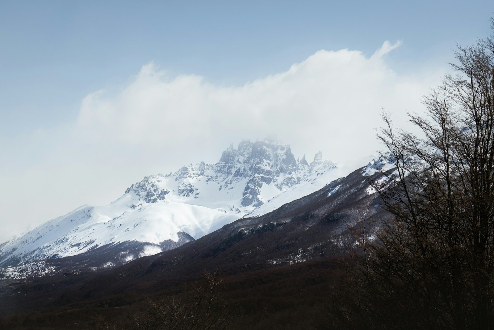
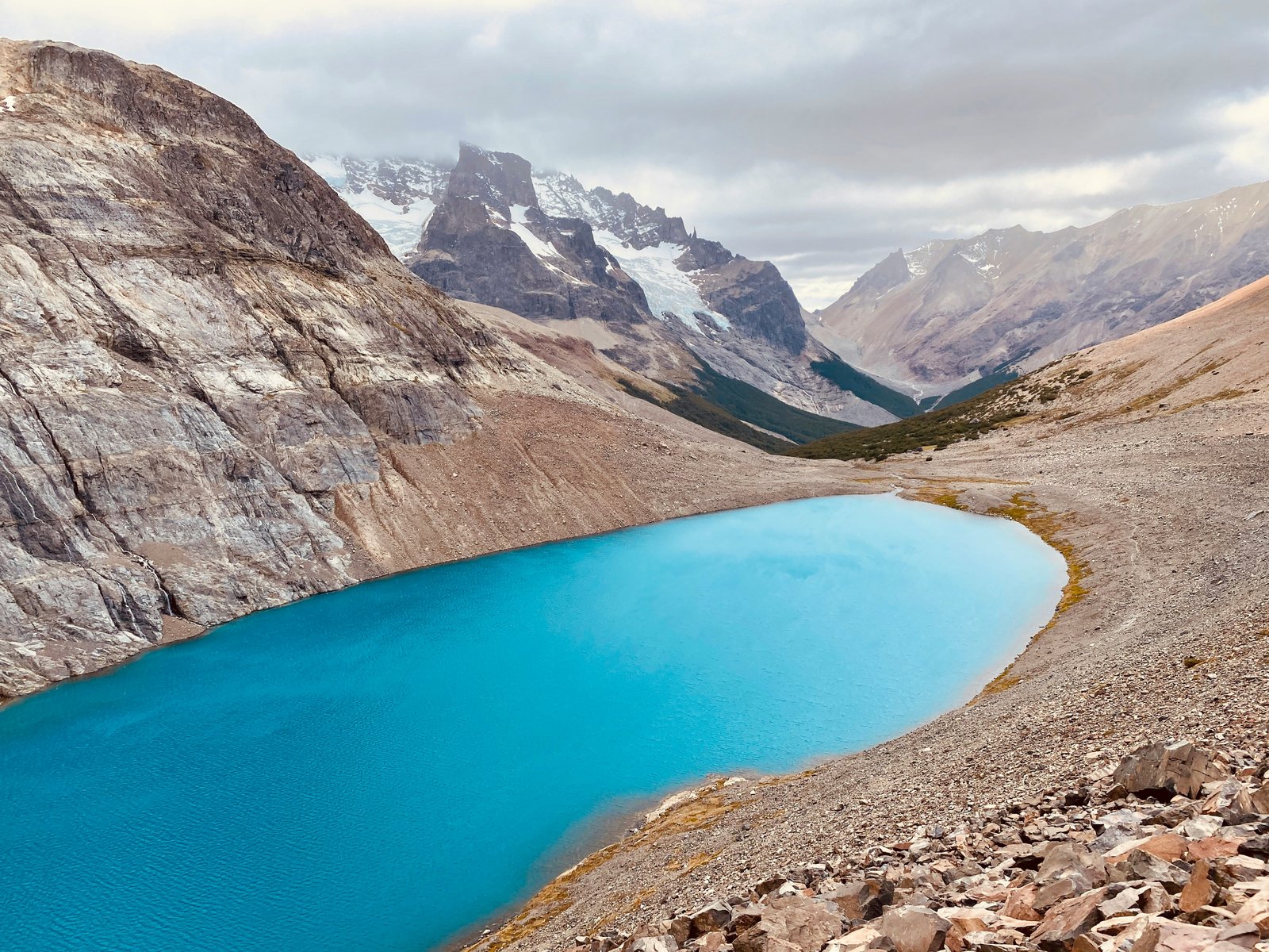
Four days on the circuit below the basalt spires. Laguna Cerro Castillo at the end of day three, and the lenga in full autumn colour the whole way down.
Common Questions
The landscapes are comparable in scale and drama — black basalt spires above hanging glaciers, similar to the granite towers of Torres del Paine. The key differences: Cerro Castillo is camping-only (no refugios, no hot meals), there are no booking systems and no crowds, the trail is less maintained, and the Portezuelo pass is harder than anything on the W Trek. Torres del Paine is more accessible and more comfortable. Cerro Castillo is more remote and more demanding, and right now significantly less visited. If you have done Torres del Paine and want the same scale of landscape with half the people, Cerro Castillo is the next logical step.
No. Unlike Volcán Villarrica, the Cerro Castillo circuit does not legally require a guide. Experienced trekkers with multi-day camping experience, navigation skills, and proper equipment can do the circuit independently. The trail is marked but not as well-maintained as Torres del Paine — a topographic map and compass or GPS is advisable, particularly for the Portezuelo pass section in poor visibility. Guide services are available from Coyhaique-based operators for those who prefer a guided experience.
The main crossings are knee to thigh deep in December and January when snowmelt is highest. Current is moderate but the riverbed is uneven rock. Trekking poles are essential for balance. Unbuckle hip belt and sternum strap before crossing so the pack can be dropped quickly if you fall. In February and March, water levels typically drop and the crossings become ankle to knee deep. If levels look dangerous after heavy rain, wait — they drop quickly once rain stops. There is no bridge on the main circuit crossings.
Technically possible for very fit trekkers who combine Days 1 and 2 into a single 30km push, but not recommended. Day 2 already includes the Portezuelo pass — adding 16km of approach to that day makes for a 12 to 14 hour day with a full pack. More practically: rushing the circuit means missing the mirador detour on Day 3, which is one of the two or three best views on the entire circuit. Four days is the right pace for most people; five gives a weather buffer day at Neozelandés camp.
The standard Patagonia itinerary combines both into a 3 to 4 week trip: fly into Santiago, fly to Coyhaique, do Cerro Castillo (4 days), drive or bus the Carretera Austral south to Puerto Natales (2 to 3 days of driving through Cochrane and Villa O'Higgins or via ferry), then do the W Trek or full circuit at Torres del Paine. Alternatively, go in the opposite direction: fly into Punta Arenas, do Torres del Paine, then drive north on the Carretera Austral to Cerro Castillo, and fly home from Coyhaique.